Part I (Day 0) – Before the Climb
Part II (Day I – Feb 18) – Aiming for Kabugan Campsite
Part III (Day 2 – Feb 19) – A Surprise at Paray-Paray
Part IV (Day 3 – Feb 20) – Manta Summit and the Traverse from Hell!
Our last day of ‘moving away from the peak’ (I could honestly not call it a descent…) was off to a stormy start. We set our alarms for 4 in the morning because we had this delusion that we’d be up for it despite the challenge that was the third day. When the alarm went off, the wind was basically howling and the rain was unforgiving so we basically just slept a little more. When we actually did wake up for real, the first thing that I said to Tin upon waking up was, “Itutuloy ba natin (are we going to continue)?” I honestly had this notion that it may be better to wait the storm out. Her reply was, “Eh pano kung lumakas pa yan (What if the storm gets stronger)?” None of us were willing to spend another night sleeping inside our then damp tents so we finally hauled ourselves up at about 6 in the morning to start preparing for the day ahead.
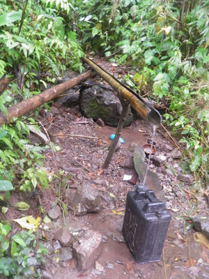
We once again set out preparing the day’s meals and since the water containers and cooksets that we left out in the rain collected enough water during the night, we had no shortage of water to deal with. From Lapong, the next water sources would already be the communities at the base of the mountain in Brooke’s Point. We had been advised that the last day would be the longest trek yet but once we get to the communities, night trek was already possible. Binoy and Tay Dinio told us that during the past climbs, their treks lasted until 9 or 11 in the evening. Regarding the trail condition, they told us that the first half of the day would probably be the same as the previous day although once we hit the communities, the trail would be much easier to navigate (seeing as the villagers regularly use them to get to Brgy. Malis). We honestly did not take their word for whatever they perceived as easier or harder trails because from that point on, we were resigned to the fact that we’d probably defying death again before we completed this Mantalingajan traverse. And you know what? We were right.
By this day, I was wearing multi-layered clothes with some improvised garbage bag interspersed their somewhere to provide some modicum of comfort against the non-stop rain. And in a sense-deprived mindset, I had this bright idea of wearing shorts because my trekking pants were soaked. So yes, as if the hand scars were not enough, by the end of the climb, the imaginary knife-wielding psycho got the better of my legs as well. Oh well, I’m gonna pass it off as battle scars or something. 😀
So we set out from Lapong at about 8:30 in the morning (way later than we anticipated) and the trail immediately reverted back to the ridiculous combination of mossy rocks and broken trees sans soil. This continued on for the better part of an hour until we reached Mag-ringgit at 10. By then, I was the designated sweeper as Fred was the one at the lead so I got to talking with Tay Dinio. According to him, he used Mag-ringgit as an emergency camp the last time they assaulted Mantalingajan and that there was a fork there that diverges to Brgy. Kamantian, which was the trail that the first group who traversed Manta took. Tay Dinio (and Binoy too at that) had no plans to repeat that traverse anymore because even for them, the Kamantian trail was too ridiculously dangerous. They resolved to hold the future traverses to the route we were taking (to Brgy. Malis) which was less…uhhm…. ‘death-defying’ (oh you’re never going to hear me say it was in any way ‘easy’).
By then, we were talking about the landmarks that we were going to hit when he told me that we were en route to an area they called Kataribunan. We were busy talking (not minding the wind and steady patter of rain on our faces) when without warning, the trail opened up to what our group infamously called the “Mag-ringgit” ridge.
Mag-ringgit Ridge, (according to Tin since I haven’t been to G2 yet) puts G2’s knife edge to shame. And she wasn’t reserved about making everyone realize this too. Remember that we were trekking in the middle of a storm? So yeah, we had to crouch so low to reduce the surface area that could be whipped by the strong winds that could easily tip us off balance as we traversed the narrow ridge that opened up to steep cliffs that were planted with small weeds on both sides. My heart was basically up my throat by that time but Tin still had the energy and annoyance, most likely, to shout something like,
“Eto ang Knife’s edge!!!! Anong sinabi ng knife edge ng G2 dito??? Dun makakatayo ka habang naglalakad eh! At least doon pag nalaglag ka, puno ang gilid eh dito ano, damo???”
So after that ridge, everything else seemed easy peasy…is what I would have loved to say back then. But no. From Mag-ringgit, we had to traverse more dangerous trails composed mainly of very loose soil that eroded at the slightest pressure. This continued on until we reached Karim at almost noon. We had a quick lunch and were told that we could reach Kawang-Kawang viewdeck by 2 PM, which offered our first view of the hi-way. But although we could see the road from there, Binoy said that it would still take 6-7 hours to reach. So after regaining our energy, we set out once more to continue the traverse at half past 12. Like the previous day, we hardly took breaks since it was too uncomfortable to stop because of the rain.
From Karim, all we had to content with were numerous ridges where we were constantly battered by the rain and that the tree you hang on to for support sways with the wind as well. The wind was so strong that we were cautioned to keep a look out for falling trees because as can be seen from the trail conditions, a lot of trees were really strewn across the barely passable trail, making the trek infinitely harder.
Besides ridges, we also had to cross numerous “kiss the wall” trails but instead of perching upon relatively stable stone…you’d have to stand on eroding soil. There was a particularly steep one where all you’d have to step on was a small root jutting outwards and hope that the soil patches do not give in. Unless, of course, your EL basically bulldozes the whole trail flat as she swings her whole body across to reach the other side. I honestly had no idea how I survived that. I think I gave my best effort to be as light as possible then prayed vigorously that the soil does not erode and lead me to the chasms of hell which I’m pretty sure had an entrance in Manta somewhere. 😉
There was also an annoyingly difficult part of the trail that should not have been there at all. The freak storm that I mentioned also affected the Brooke’s Point side of Mantalingajan and as a result, a huge landslide basically eroded a section of the mountain. We had to take extra caution here since there was no stable step anywhere. And it didn’t help that Binoy and we had a classic case of “go-right-I-mean-my-right-which-means-your-left” when asking where to step! And to rub it all in, Tay Dinio would incessantly tease us that during their last climb, that particular section was, in fact, very easy to navigate. From there on, I got into the habit of asking Tay Dinio every time a particular roadblock pops up if it was there before or not. And every time a new one comes up, he’d go, “Kayo lang talaga inantay.” You’d think we’d be offended but after 3 days of unexpected circumstances, nothing can surprise us anymore 😀
We reached Kawang-Kawang at about 2 o’clock and like the previous days, there was no clear view although we did see glimpses of where we were heading. I asked the group if they’d allow me to take the lead this time since we were at the last stretches of the traverse so Binoy and I became the lead men by that point. The rain also subsided a little so I got my camera out as we set off for Brgy. Malis once more.
Personally, that last stretch flew by because of the stories Binoy and I were telling each other. It really helped take my mind off the difficulty of the trail although there were times when we’d stop talking and cross a dangerous trail and I’d nonchalantly go, “Ang tarik din nun ah (that was steep).” He told me about his life, his family and everything else we could talk about. I talked to him about past climbs and how I got to meet Tin and Fred and why we dared to this trav in the first place. Before we knew it, we were already at Mag-agong by 4 PM despite his estimate that we’d reach it by 5.

the now-decrepit hut that Binoy and other mountaineers had to use as an e-camp during the last traverse
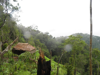
the hut that sparked a discussion on what is a viable material for atip (roof): the answer: tigbak. A local tree with banana-like leaves which according to Binoy are sturdier than niyog

baby tobacco leaves, at first I thought they were wild but Binoy told me that they were most likely being cultivated by one of the residents nearby

the kaingin that made Binoy and I muse how the hell the people harvest or even plant on such steep slopes. According to Binoy, at Balin-Balin, they don’t slash and burn areas that are too steep like this one
Mag-agong mirrored that of Batulao during its windy season and if the cogon in Batulao were much more overgrown. From there, we could clearly see the Brooke’s Point landscape, some houses and even the hi-way that we were aiming for. Around this area, Binoy told us that the winds were really battering, storm or no, and it made a sound that they likened to that of a gong. Thus the name Mag-agong (Agong is a local term for a type of gong). He also explained that Mag-ringgit was named because ‘ringgit’ meant ‘spiral’ which was how the trail could be described (you’d have to circle back the mountain in order to traverse it).
From Mag-agong, we trekked continuously until we finally saw the settlements of some Pala’wan tribes people, some of which were Binoy and Tay Dinio’s relatives. We stopped by a sari-sari store that one of their relatives owned to have a quick dinner. I suggested we did so that we’d have enough energy to continue trekking through the dark since it was still 2 or 3 hours to the hi-way depending on the pace. We actually had to stay a while at the store since the rain suddenly increased heavily so we had no choice but to wait it out. I was getting excited by this point because the end seemed so near which was why I gave the rest of my trail food to the cute smiling kid who was innocently staring at the three mountaineering idiots who were passing by. 😀
We resumed at about 5:30 and after a last stretch of steep muddy trails (which Binoy and I basically just ran since we found it easier), we reached the flatlands at about 6 in the evening. From there on, the trail (thankfully I might add) became very easy so we just told jokes and stories while adopting a relaxed but quick pace. Binoy and I reached the hi-way at exactly 7 o’clock almost without warning. We were talking about installation of electricity or development in the communities or something and I was commenting if there were any attempts to build a better road since the road that we were plying could accommodate vehicles already. He said that there were none that he was aware of at the time when a pair of headlights suddenly loomed nearby. At first I thought that a jeep was heading for us via the rough road so I admonished Binoy to step aside to let the jeep through to which he said, “Hindi kuya, truck na yun. Ayan na yung hi-way eh.” Then he laughed out loud. 😀 I guess we were talking to each other so much that I didn’t realize how far we’d already trekked and that the traverse was finally at its end.
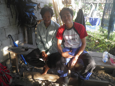
I could’ve cried but I held it this time. I updated friends and family that we made it safe then we headed directly to the house of Tay Dinio’s uncle (hating myself for forgetting the name…) where we cleaned up ourselves, had dinner and stayed the night.
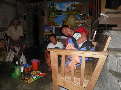
We held a mini-socials over bottles of Emperador since we promised Binoy that we’d at least celebrate his birthday and the day after was Fred’s birthday as well. So there we were: exhausted, battered, scarred and bruised… but laughing our hearts out whenever Fred gets too chatty and holds up the tagay for too long, whenever we recall what we just went through or whenever Binoy becomes incredulous at something in his usual high-pitch voice. 😀
We couldn’t believe it. We’d done it in 4 days. We were the first to do so according to Tay Dino and Binoy and although that added icing to the cake, that’s not what I’m going to take away from our Mantalingajan traverse. It was an epic climb for a myriad of reasons. Some were ideal and some were not, but oddly enough, I’d look back fondly at all of them. From my co-climbers Tin and Fred, to new friends Tay Dinio and Binoy, to Typhoon Crising crashing our climb, to trails not mean for mortals, to dried water sources, to hyperactive thorny vines and to everything else in between, it was definitely a climb of a lifetime. And although you’d been very fickle and temperamental during our stay in your slopes, I’ll forever love you Mt. Mantalingajan. I can’t wait to go back!!!
…actually I could wait, maybe a year or so and probably only a back trail next time haha

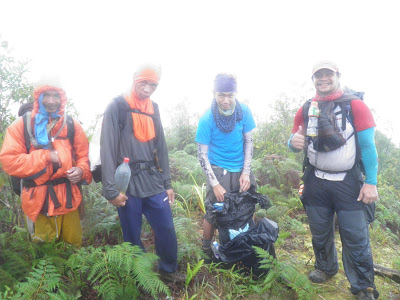







I was still in a groggy/bangag state when you asked kung itutuloy pa ba natin at ang naisip ko nun ay "What choice do we have, really?" Kung pwede lang sanang magpa-airlift na lang. Hahaha
Pingback: Mt. Mantalingajan Traverse: Before the ‘Climb’ | the fine line
Pingback: Mt. Mantalingajan Traverse Day 1: Aiming for Kabugan Campsite | the fine line
Pingback: Mt. Mantalingajan Traverse Day 2: A Surprise at Paray-Paray | the fine line
Pingback: Mt. Mantalingajan Traverse Day 3: Manta Summit and the Traverse from Hell! | the fine line